Hiking Mont-Tremblant National Park: trail-by-trail guide
Sentier des Cimes Treetop Observatory
Duration: 2 hours
Is the Mont-Tremblant national park the same as the ski resort?
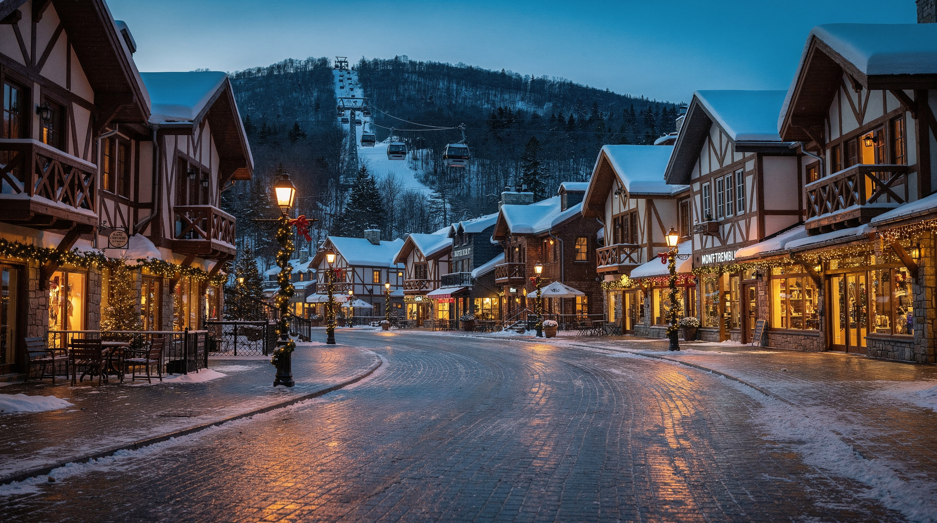
No. Parc national du Mont-Tremblant (1 510 km², Sépaq) is a separate wilderness park, distinct from the Mont-Tremblant resort village. The park has 400 km of trails, Lac Monroe for canoeing, and backcountry camping. Entry ~9.85 CAD/adult. The resort gondola and ski runs are operated independently.
The park most visitors confuse with the resort
Parc national du Mont-Tremblant is the kind of place that rewards travellers who do a little research before arriving. It is frequently confused with the ski resort that shares its name. The two have nothing in common operationally. The park — 1 510 km² of Laurentian wilderness managed by Sépaq — begins where the resort’s ski runs end, about 10 km north of the pedestrian village. Its scale is entirely different: four times larger than the resort’s skiable terrain, with 400 km of hiking and multi-use trails, dozens of named lakes, and a backcountry network that takes most visitors more than a day to scratch the surface of.
The park is also older than the resort. Created in 1894, it is the oldest provincial park in Québec, pre-dating the ski industry by decades. That history shows in the old-growth sections of the trail network, where sugar maples reach heights that the more commercially logged areas around the resort cannot match.
This guide focuses on the hiking trails specifically. For resort activities (gondola, Sentier des Cimes), see the family-friendly Mont-Tremblant guide.
The sectors
The park is divided into three main access sectors, each with its own entry, parking, and trail network:
Secteur de la Diable — the most visited sector, with the main visitor centre, Lac Monroe, beach area, and the majority of day-hiking trails. Located off Route 1 from the resort village.
Secteur de l’Assomption — the eastern sector, less visited, with more challenging trails and the park’s highest peak accessible terrain.
Secteur de la Pimbina — the western sector, accessed from Labelle. More remote, ideal for multi-day canoe-camping circuits.
Most day visitors use the Secteur de la Diable. This is where the trails in this guide are located unless otherwise noted.
The key trails
Sentier de la Roche — moderate (6 km return)
The best single-day hike for views. The trail climbs steadily through boreal forest to an exposed rocky summit at 880 m with open views over the Laurentian lake country. The final 300 m involves some light scrambling on rock slabs — not technical, but not suitable for those uncomfortable with uneven terrain.
Distance: 6 km return. Elevation gain: 380 m. Duration: 3 to 4 hours. Best season: June to mid-October. Peak foliage late September. Trailhead: Secteur de la Diable, parking lot P5.
The summit has no formal viewpoint structure — just open rock. Bring a windbreak layer; the exposure on top can be significant in September.
Sentier Centenaire — hard (22 km, multi-day)
The park’s long-distance trail, running the length of the Secteur de la Diable. Named for the park’s centennial, the Centenaire crosses varied terrain over two days with overnight shelter use at midpoint. The trail passes several named lakes, river crossings on log bridges, and boreal forest sections where moose habitat is dense.
Distance: 22 km total (typically hiked in 2 days with overnight). Elevation gain: Cumulative 900+ m. Duration: 2 days. Shelters: Two Sépaq shelters along the route (reservation mandatory, opens in February). Difficulty: Demanding physical fitness required. Navigation experience an asset for the middle section.
This is the trail that distinguishes the park from a simple day-trip destination. If you have two days and backcountry experience, the Centenaire is worth planning around.
Sentier du Diable — moderate (12 km)
The Diable (Devil) river trail follows the upper course of the Rivière du Diable — the same river that drains south through the resort valley. The riparian forest here is mature and diverse; the trail passes through several microhabitats within a few kilometres. Beaver activity is visible throughout. No major elevation changes.
Distance: 12 km out-and-back (or loop with connecting trail). Elevation gain: 200 m. Duration: 4 to 5 hours. Wildlife: Moose are regularly seen in the beaver pond sections. Osprey nest near the larger pools.
This trail works well in summer heat because the forest canopy is almost complete — the temperature under the trees runs 5–8°C below the open meadows.
Sentier du Lac-des-Femmes — easy (5 km loop)
The accessible family option. A gentle loop around a small boreal lake with a picnic area at the midpoint. The trail is well-maintained, shaded, and appropriate for children from age 5 upward with minimal experience.
Distance: 5 km loop. Elevation gain: 80 m. Duration: 1.5 to 2 hours. Best for: Families, first-time visitors, those combining hiking with a beach afternoon at Lac Monroe.
Pic Johannsen — moderate to hard (14 km return)
The highest accessible trail in the park, reaching the eponymous 960 m summit through a combination of well-graded trail and open ridge walking. Named for Herman “Jack” Johannsen, the Norwegian-Canadian skier who pioneered cross-country skiing in the Laurentides in the early 20th century. Summit views extend north over the undeveloped boreal plateau.
Distance: 14 km return. Elevation gain: 480 m. Duration: 5 to 6 hours. Trailhead: Secteur de l’Assomption.
Note that the Secteur de l’Assomption requires a separate 40-minute drive from the Secteur de la Diable. Plan accordingly if visiting both in a day.
Lac Monroe: paddling and beach
Lac Monroe is the social heart of the park’s summer season. The 5 km² lake has a supervised beach (lifeguards June to August), canoe and kayak rental, and access to a paddling circuit connecting to neighbouring lakes.
Canoe rental: Approximately 30–45 CAD for 3 hours. Kayak rental: Similar pricing. Multi-day paddles: The lake connects via portage to Lac du Diable and further into the lake country. Sépaq maps and permits are available at the Lac Monroe rental station. Beach: Opens mid-June, closes Labour Day (first Monday in September). No lifeguard after Labour Day.
The combination of a morning hike (Sentier de la Roche or Pic Johannsen) and an afternoon at Lac Monroe makes for an excellent full-day park visit.
Treetop walking near the resort
For a different perspective on the Tremblant landscape — looking down from the tree canopy rather than up at the mountain — the Sentier des Cimes attraction at the resort is worth knowing about:
Sentier des Cimes treetop observatory (Mont-Tremblant resort, 2 hours) — an elevated walkway through the forest canopy reaching 10 m above the forest floor, with a glass-floored observation platform at the top. Family-friendly, no hiking fitness required. This is at the resort, not inside the national park; but it combines naturally with a park hiking day.
For visitors coming from Montréal without a car:
Mont-Tremblant National Park hiking day trip from Montréal — includes transport from the city and guided park hiking. Covers the main trails and handles the 2-hour-each-way transfer.
White water on the Rouge River
Adjacent to the national park, the Rivière Rouge offers some of the best day-trip white-water rafting accessible from both Montréal and Tremblant. Not inside the park, but a natural complement to a hiking visit.
Half-day white water rafting on the Rouge River (3–4 hours) — launches from a staging area 15 minutes from the resort. Class II–III rapids. Suitable for beginners from age 12. ~80 CAD.
Wildlife in the park
Moose (orignal): Common throughout the park, particularly near beaver ponds and river sections. The Secteur de la Diable river trail and the marshy sections near Lac Monroe are productive early morning spots.
Black bears: Present and occasionally seen. Follow standard precautions (food storage, group hiking, noise).
Wolves: The park is part of a wolf pack territory. Sightings are rare; howling at night is not uncommon in autumn.
Loons (plongeon huard): The lake network hosts a healthy loon population. Early morning paddling on Lac Monroe almost always produces a sighting.
Getting to the park
The main entrance to Secteur de la Diable is approximately 130 km from Montréal (about 1 hour 45 minutes by car via Autoroute 15 North). From Québec City the drive is approximately 250 km (2 hours 45 minutes).
There is no public transit to the park interior. A car is essential.
From the resort village: the national park visitor centre is approximately 10 km north on Chemin du Lac-Supérieur. The drive takes 15 minutes from the main resort parking.
Parking: Main lots at the visitor centre and Lac Monroe fill early on sunny summer weekends (after 10h). Arrive before 9h to secure a spot. Parking is free with your park entry fee.
Practical information
- Entry fee: ~9.85 CAD/adult, children under 18 free with paying adult (Sépaq 2026)
- Visitor centre: Open daily June to October, 8h30–17h
- No fuel: There are no gas stations inside the park
- Cell coverage: Minimal to none in most of the park interior
- Dogs: Permitted on leash on designated trails only (verify at entry)
Related guides
- Family-friendly Mont-Tremblant: summer and winter
- Best hikes in Québec
- Mont-Tremblant destination guide
- Day trips from Montréal
Frequently asked questions about Hiking Mont-Tremblant National Park: trail-by-trail guide
How large is Mont-Tremblant National Park?
Parc national du Mont-Tremblant covers 1 510 km², making it the largest provincial park in southern Québec. It spans portions of three regional county municipalities and contains several lakes, rivers, and a diverse boreal-hardwood transition forest.What is the difference between Mont-Tremblant national park and the resort?
The resort (Station Mont-Tremblant) is a private four-season ski and summer destination with hotels, gondola, shops, and restaurants. The national park (Sépaq) is a protected wilderness area 10 km north. They are geographically close but operationally independent. Day visitors can combine both.Can I go canoeing in Mont-Tremblant National Park?
Yes. Lac Monroe and several other lakes have canoe and kayak rental at the Lac Monroe sector. Several multi-day paddling routes connect park lakes. Canoe camping at designated lakeside sites requires advance Sépaq booking.Are there easy hikes in Mont-Tremblant National Park for families?
Yes. The Sentier du Lac-des-Femmes (5 km, minimal elevation) and the Sentier de la Corniche (3 km loop) are appropriate for families with children aged 6+. The Lac Monroe beach area and picnic zones require no hiking at all.When does Mont-Tremblant National Park open?
The park is open year-round. Summer season (full services, all trails, canoe rental) runs mid-May to mid-October. Winter activities (skiing, snowshoeing, fat biking) operate from December to mid-March. Spring thaw (April to mid-May) can make some trails muddy and partly closed.
Top experiences
Bookable activities with verified prices and instant confirmation on GetYourGuide.