Hiking the Saguenay Fjord: Statue, Cap-Trinité and beyond
La Baie: 3-Hour Saguenay Fjord Classic Cruise
Duration: 3 hours
What are the best hikes in the Saguenay Fjord?
Cap-Trinité (8.5 km return, 450 m gain, hard) for the best summit views; Sentier Statue de la Vierge (1.5 km, steep, accessible) as a shorter alternative; Sentier du Fjord (35 km, expert, 3 days) for the full traverse. Entry ~9.85 CAD (Sépaq). Season is May to October.
The Saguenay Fjord: hiking at the edge of the world
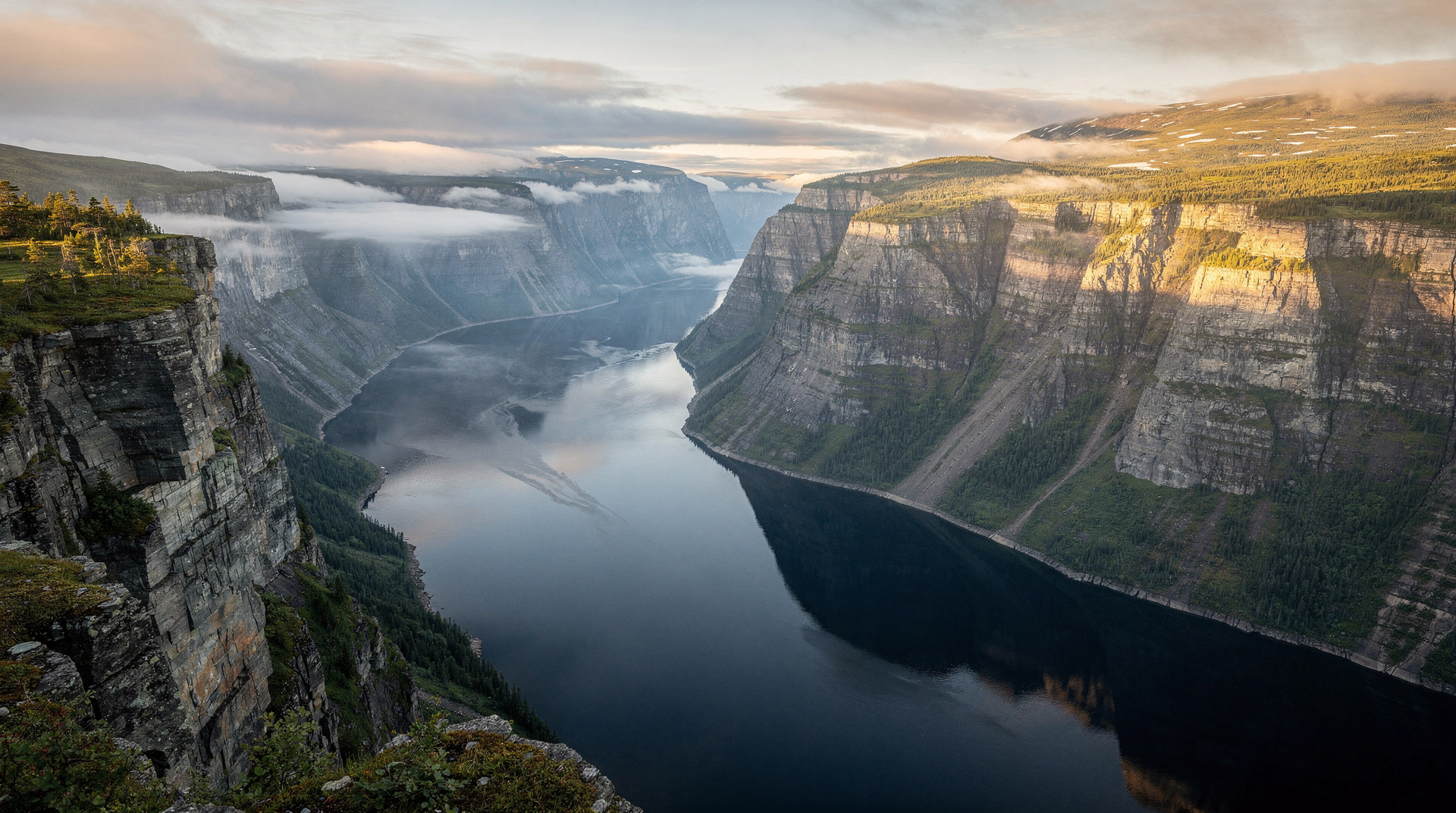
The Saguenay Fjord is one of the most striking landscapes in North America. Over 100 km long, up to 275 m deep, with sheer black anorthosite cliffs rising 300–400 m above the water on both sides — the fjord was carved by glaciers during the Quaternary period and filled with seawater when sea levels rose, creating a genuine fjord at the latitude of northern France. It is unusual enough that UNESCO has repeatedly considered the area for World Heritage status.
For hikers, the fjord offers three distinct experiences at different ability levels: a dramatic, steep ascent to Cap-Trinité; a short but punishing trail to the famous Notre-Dame statue; and — for those with serious backcountry ambition — a 35 km traverse along the western shore that has no equivalent in eastern Canada.
This guide covers all three, plus the logistics of combining hiking with the fjord cruise that most visitors consider the centrepiece of their Saguenay trip.
Understanding the fjord geography
The key landmarks:
Cap-Trinité — a triple cape of black gneiss on the east bank of the fjord, rising to 518 m above sea level. The 9-metre Notre-Dame statue on the second cape was installed in 1881 by a sailor who survived a storm and made a vow.
Rivière-Éternité — the small village at the base of Cap-Trinité where the main park sector is located. This is where most hikers start.
Sainte-Rose-du-Nord — a village on the north shore of the fjord, access point for the Sentier Statue de la Vierge and the northern end of the Sentier du Fjord.
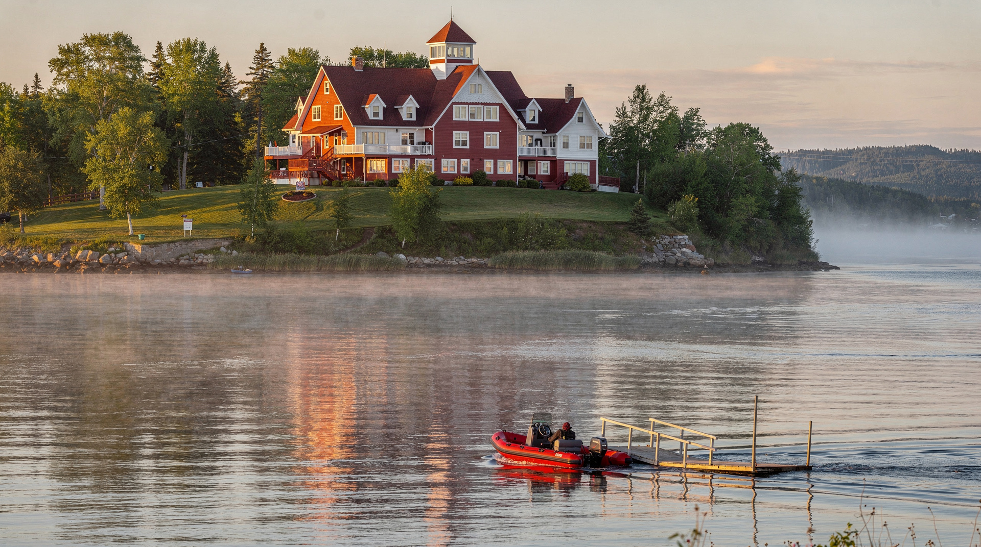
La Baie — the urban sector of Saguenay city on the south shore, departure point for the fjord cruise.
The hikes
Sentier Statue de la Vierge — short and steep (1.5 km one way)
The most accessible route to the Notre-Dame statue at the second cape. From the trailhead near Sainte-Rose-du-Nord, the trail climbs 200 m in 1.5 km — an average gradient of roughly 13%, with sections steeper than that. The surface is root-crossed and uneven; trekking poles are strongly recommended.
Distance: 1.5 km one way (3 km return). Elevation gain: 200 m. Duration: 1.5 to 2 hours return. Difficulty: Moderate despite the short distance — the steepness is sustained. Views from the statue: The fjord stretches north and south from this point. In July and August, belugas are occasionally visible far below in the dark water.
This trail is the right choice if you have 2 hours, are not looking for a full mountain day, or are hiking with fit but not highly experienced companions.
Cap-Trinité — the full summit (8.5 km one way)
The complete ascent continues beyond the statue trail to the true summit of Cap-Trinité at 518 m. The views from the summit are qualitatively different from those at the statue: a 360° panorama that includes the fjord length in both directions, the opposite shore cliffs, and on clear days the Saint-Laurent widening to the northeast.
Distance: 8.5 km one way from the Rivière-Éternité trailhead (not from the Sainte-Rose-du-Nord statue trailhead). Elevation gain: 450 m. Duration: 5 to 7 hours return. Difficulty: Hard. The trail involves sustained climbing, some exposed sections near the upper crags, and a final approach that requires careful footing on rock slabs. Starting point: Parc national du Fjord-du-Saguenay, Secteur de Rivière-Éternité.
The Rivière-Éternité sector has a visitor centre, parking, and a campground. Reserve campsites through Sépaq well in advance for July and August.
The combination of hiking up the east bank to Cap-Trinité and taking the cruise from La Baie on the same day or the following morning is one of the most rewarding two-activity days in the Saguenay.
Sentier du Fjord — expert traverse (35 km, 3 days)
The Sentier du Fjord traverses the western shore of the fjord over approximately 35 km from Sainte-Rose-du-Nord to Rivière-Éternité. It is not a loop; point-to-point logistics require either a shuttle or a return trip.
Distance: 35 km. Elevation gain: Cumulative 3 000+ m (significant daily undulations following the cliff topography). Duration: 2 to 3 days with overnight shelter use. Shelters: Three Sépaq backcountry shelters along the route. Reservation mandatory (book in February for summer dates). Difficulty: Expert. The trail involves several sections of steep descent to stream crossings and re-ascent. Navigation in places requires reading the terrain. Route is marked but not always obvious.
This is not a casual multi-day. Hikers should be comfortable with sustained elevation change over consecutive days, able to navigate with a topo map, and self-sufficient for 3 days between shelters. The reward is unparalleled: views of the fjord that only this trail provides, solitude (the Sentier du Fjord sees a fraction of the visitors of the day trails), and the physical satisfaction of having crossed one of the most dramatic landscapes in eastern Canada on foot.
The fjord from the water
For context on what you are hiking above, or as a complement to the trail, the fjord cruise from La Baie is outstanding:
Saguenay Fjord classic cruise (La Baie, 3 hours) — the boat passes directly below Cap-Trinité, which allows you to see the Notre-Dame statue from the water and understand the scale of the cliffs from a perspective impossible from above. The cruise also passes beluga habitat near the fjord mouth (~36 CAD).
For a version that combines the fjord with Tadoussac whale watching:
Whales and Fjord morning or twilight tour (Tadoussac) — departs from Tadoussac where the Saguenay meets the Saint-Laurent, the most productive whale-watching spot in the province. The twilight departure gives extraordinary light on the fjord cliffs.
Wildlife and natural history
Belugas (beluga du Saint-Laurent): The Saint-Laurent beluga population (currently around 900 individuals) uses the fjord mouth and the Saguenay estuary as summer habitat. They are visible from the cruise boats and occasionally from shore at Sainte-Rose-du-Nord and Tadoussac, but reliably only from a boat.
Black bears: Present throughout the park, particularly in berry-rich sections of the Sentier du Fjord. Standard precautions apply.
Peregrine falcons: Nest on the fjord cliffs. The species recolonised the Saguenay after the DDT ban in the 1970s; nesting pairs are now established on Cap-Trinité itself.
Geology: The dark cliffs are anorthosite, an unusual rock formed from plagioclase feldspar that makes up most of the lower crust. The Saguenay anorthosite complex is one of the world’s largest exposures of this rock type. The black colour is characteristic and dramatically different from the pale limestone cliffs of, say, Forillon.
Logistics
Getting to Rivière-Éternité
Rivière-Éternité is 200 km north of Québec City (about 2 hours 30 minutes by car) and 225 km northeast of Montréal. No public transit serves the park sector. A car is essential.
From Tadoussac: 100 km south along Route 170, approximately 1 hour 30 minutes.
Accommodation near the park
Rivière-Éternité: The park campground is the primary on-site option. Several B&Bs and auberges in the village itself.
Chicoutimi/La Baie: The urban centre of the Saguenay region has hotels ranging from budget chains to mid-range independents. Better restaurant options than the village.
Sainte-Rose-du-Nord: A small, beautiful village on the north shore with limited but quality accommodation. Worth an overnight for the fjord views at dawn.
Combining with a wider Saguenay trip
A 3-day Saguenay itinerary that combines hiking and wildlife:
- Day 1: Arrive via Québec City. Afternoon fjord cruise from La Baie.
- Day 2: Cap-Trinité hike from Rivière-Éternité. Return to base.
- Day 3: Drive to Tadoussac via Route 172. Morning whale watching.
This covers the best of the region without backtracking. From Tadoussac, Charlevoix is 100 km south via Route 138 — a natural extension.
Entry fees and practical information
- Entry fee: ~9.85 CAD/adult (Parc national du Fjord-du-Saguenay, Sépaq)
- Visitor centre Rivière-Éternité: Open June to October, 8h30–17h
- Trail maps: Available at the visitor centre and downloadable from Sépaq’s website
- Cell coverage: Very limited inside the park. Satellite communicator recommended for the Sentier du Fjord.
- Weather: The fjord creates its own microclimate. Fog is common in the morning and can persist until midday even when the plateaux above are clear.
Related guides
- Best hikes in Québec
- Saguenay Fjord destination guide
- Tadoussac whale watching guide
- Gaspésie and Chic-Chocs trekking
Frequently asked questions about Hiking the Saguenay Fjord: Statue, Cap-Trinité and beyond
How long is the hike to Cap-Trinité in the Saguenay Fjord?
The trail is approximately 8.5 km one way from the main trailhead near Rivière-Éternité, with a return route totalling 17 km and 5 to 7 hours. For a shorter visit, the 1.5 km Sentier Statue de la Vierge reaches the famous Notre-Dame statue partway up, with views of the fjord but not from the full summit.Can I combine hiking with a fjord cruise?
Yes, and this is the recommended approach. Hike Cap-Trinité in the morning for the aerial perspective, then take the afternoon cruise from La Baie to see the cliffs from the water. The scale difference is dramatic — the cliffs look much taller from the boat.What is the Sentier du Fjord?
A 35 km expert trail traversing the western shore of the Saguenay Fjord from Sainte-Rose-du-Nord to Rivière-Éternité. It requires 2 to 3 days with overnight shelters or camping. Significant elevation changes and remote sections. Only recommended for experienced hikers with backcountry navigation skills.Are beluga whales visible from the hiking trails?
Sometimes, but not reliably. The fjord near Sacré-Cœur and Sainte-Rose-du-Nord occasionally has beluga and fin whale sightings from shore, especially in July and August. For reliable whale viewing, a boat tour from Tadoussac (where the Saguenay meets the Saint-Laurent) is far more effective.Is the Saguenay Fjord hike suitable for families?
The Sentier Statue de la Vierge (1.5 km) is doable for fit families with children aged 10+. The steepness is significant but the trail is short. Cap-Trinité (full route) is not appropriate for children under 12. The fjord cruise is an excellent family alternative that requires no hiking.
Top experiences
Bookable activities with verified prices and instant confirmation on GetYourGuide.