Gaspé Peninsula
Quebec's wild Atlantic coast: a 1 400 km loop past Percé's rock, Forillon's cliffs, the Chic-Chocs peaks, and the Baie-des-Chaleurs.
3-Day Gaspésie Trip from Montreal
Duration: 3 days
Quick facts
- Distance from Montreal
- ~1 000 km to Percé (10-12h by car)
- Distance from Quebec City
- ~700 km to Percé (7-8h by car)
- Loop distance
- ~1 400 km (full peninsula circuit)
- Best airport
- YGP (Gaspé, seasonal flights from Montreal)
- Foliage peak
- Late September to early October
The great Gaspésie loop
The Gaspé Peninsula is Quebec’s most dramatic landscape and its most misunderstood destination. Most visitors either skip it (too far) or rush it (one week is genuinely not enough to feel unhurried). But those who allow 5-7 days discover something rare in eastern North America: a wild coastline that still feels inhabited by fishing families who have been there for generations, mountains that rise abruptly from the sea, and a pace of life that the province’s cities have largely abandoned.
The peninsula is a 1 400-km loop from Sainte-Flavie (on the Trans-Canada highway) around the coast and back. The standard approach drives the south shore — following the Baie-des-Chaleurs — then rounds the tip at Forillon National Park and returns along the St-Lawrence north shore. The reverse is equally valid; most travellers do the south shore outbound and the St-Lawrence inbound because the Chic-Chocs are better in the afternoon light heading west.
Honest logistics first: from Montreal, Percé is approximately 1 000 km — a 10-12 hour drive without stops. There is no practical way to reach the peninsula by train (the old railway was abandoned). There are seasonal flights from Montreal (YUL) to Gaspé (YGP) on Air Canada Express, typically May through October, which cuts the travel equation dramatically. If you have 5-7 days and want to see the peninsula properly, fly into Gaspé, rent a car, and loop home via Quebec City. If you drive the full loop from Montreal, plan 2 days of driving to reach the tip and 2 more to return — leaving 3 days for actual exploration.
| Where | Quebec’s easternmost peninsula, a ~1 400 km loop from Sainte-Flavie |
| Cost | Around 150–200 CAD/day (mid-range) plus 300–400 CAD fuel for a full loop |
| Time needed | 5–7 days for the full loop; 3 days minimum via a fly-in to Gaspé |
| Getting there | Self-drive, or fly Montreal–Gaspé (YGP) seasonally and rent a car locally |
| Best time | June–October; peak July–August; avoid November–April (most services closed) |
Guided option: 3-day Gaspésie trip from Montreal
For travellers without a car or who prefer not to tackle 1 400 km alone, this 3-day Gaspésie guided tour from Montreal covers the peninsula’s highlights in a small group. It departs Montreal, follows the south shore circuit with stops at Percé and the main lookouts, and returns via the St-Lawrence. The compressed itinerary works as an introduction; independent travellers with more time will want to extend the southern coast stops.
The route: south shore (Matapédia to Percé)
Matapédia and the Restigouche valley: the peninsula begins at Matapédia, a small border town between Québec and New Brunswick on the Restigouche River — one of the best Atlantic salmon rivers in Canada. The valley has salmon camps and a few riverside inns; if fishing is your purpose, this is the entry point. Otherwise, continue west along Route 132.
Carleton-sur-Mer: the first substantial town on the Baie-des-Chaleurs, with a sandy beach, a marina, and a reasonable restaurant scene. Mont Saint-Joseph (altitude 555 m, accessible by car to the summit) gives one of the best panoramic views on the south shore — the Baie-des-Chaleurs stretching toward Campbellton and New Brunswick across the water. Carleton has the best grocery stores and fuel before the more remote stretches ahead.
Paspébiac: notable for the Banque-et-Cour, a historic wooden warehouse complex from the 18th century linked to the fishing trade between Britain and the peninsula. Small but genuinely interesting; 90 minutes is enough.
New Carlisle: the Loyalist town of the Gaspé south shore, with a cluster of clapboard houses that looks anachronistically English. Worth 30 minutes if you’re passing.
Bonaventure: a quiet fishing town with good access to the bay. The Musée acadien du Québec tells the story of Acadian settlement in the region — one of Quebec’s less-told histories.
Percé: the peninsula’s iconic destination — see the dedicated Percé page for full detail. Allow 2 full days here: one for the Rocher Percé at low tide (walkable to the base April-October, wading involved) and the boat tour around the rock; one for Île Bonaventure and the gannet colony.
The tip: Forillon National Park and Gaspé
Forillon National Park is the exclamation point of the Gaspé Peninsula — the land ends here, cliffs drop into the St-Lawrence, and black bears walk the shoreline at dawn. Allow a full day, ideally two. See the dedicated page for trail detail.
Gaspé (town): the administrative centre of the Gaspé region, with some services and a cathedral. Worth a half-day for Cathedral heritage and the Jacques-Cartier monument. Fuel and grocery stop for Forillon access.
The north shore: Chic-Chocs and Sainte-Anne-des-Monts
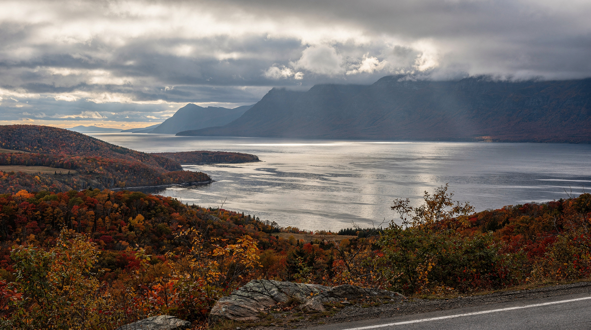
The return journey along the St-Lawrence north shore is categorically different from the south. Where the Baie-des-Chaleurs was warm, sheltered, and relatively hospitable, the St-Lawrence shore is exposed, windswept, and backed by the Chic-Chocs mountains — a chain that rises to over 1 000 m and holds snow into June.
Chic-Chocs Mountains: the proper hiking base is Sainte-Anne-des-Monts, home to the Gîte du Mont-Albert (the classic Chic-Chocs lodge) and the Réserve faunique des Chic-Chocs. The Parc national de la Gaspésie covers the summit zone with Québec’s only caribou herd south of the 50th parallel. Caribou sightings are most reliable in July-August at high altitude.
Grande-Vallée, Sainte-Anne-des-Monts, Mont-Louis: fishing villages of varying size, each with basic services, scenic wharves, and the St-Lawrence surf crashing against the shore. The drive between them, with the Chic-Chocs as a backdrop, is one of the more consistently beautiful road sections in Quebec.
Matane: significant as the departure point for the ferry crossing to Côte-Nord (to Godbout and Baie-Comeau) — a 2h30 to 4h crossing that offers a shortcut if you’re heading north, or a scenic add-on to the peninsula loop. The ferry operates mid-May to December; check the schedule (CTM — Traversiers Québec) at least a week in advance in July-August.
Sainte-Flavie: the re-entry to the Trans-Canada marks the official end of the loop. The Gaspé Peninsula is behind you.
Saisonnalité and critical closures
The peninsula lives almost entirely on a summer rhythm. Understand this before you go:
| Period | Crowds and services | Notes |
|---|---|---|
| Late May–June | Services reopening, quieter | Good weather odds, lower prices, some businesses still ramping up |
| July–August (peak) | Genuinely crowded at Percé and Forillon | Book accommodation 6–8 weeks ahead; caribou sightings best at altitude in the Chic-Chocs |
| September (shoulder) | Crowds down ~40%, most services open | Best compromise of weather, availability, and quiet; foliage starts late in the month |
| October | Peak foliage early in the month, services thinning | Many businesses close mid-to-late October |
| November–April | Closed season | Most hotels, restaurants, and attractions shuttered; driving possible but with little to stop for |
- Inland routes: some secondary roads through the Chic-Chocs can be difficult in winter and early spring; check provincial road conditions at www.quebec511.info.
Practical logistics
Accommodation: book accommodation in Percé and at the Gîte du Mont-Albert (Chic-Chocs) well in advance for July-August. These two places genuinely sell out. Other stops on the south shore (Carleton, Bonaventure) are easier to book last-minute in June-September.
Fuel: gas stations exist in all towns, but the gaps between some north-shore villages can be 60-80 km. Fill up whenever you’re below half a tank on the north shore.
Cell coverage: reliable in towns along Route 132. Between major villages on the north shore, coverage drops to 2G or nothing. Download offline maps before departure.
Whale watching: Gaspésie waters see fin whales, minke whales, and porpoises, especially in the Parc marin du Saguenay–Saint-Laurent’s area further north. From the peninsula itself, whale sightings from shore (binoculars helpful) are possible on the north coast but not guaranteed. Tadoussac remains the better base for dedicated whale watching.
Language: the Gaspé Peninsula is predominantly French-speaking, more so than Montreal or even Quebec City in the smaller villages. English is spoken in the tourism-facing businesses of Percé and Gaspé town, but the south-shore fishing villages and the Chic-Chocs region are firmly French-first. A few key phrases go a long way, and staff are generally patient with visible effort.
With kids: the peninsula works well for families who enjoy the outdoors — Forillon’s shorter trails, tidepooling at low tide near Percé, and the boat tour to Île Bonaventure’s gannet colony are all manageable with children. The long driving days are the real constraint; breaking the loop into shorter daily legs (150–200 km rather than 300+) keeps the trip enjoyable rather than exhausting for younger travellers.
Road quality: Route 132 is fully paved and maintained. Some park access roads are gravel (Forillon’s Cap-Bon-Ami access road, some Chic-Chocs trails). A standard rental car is sufficient everywhere on the main route.
Where to stay along the route
Carleton-sur-Mer: Hôtel Baie Bleue — reliable 3-star with sea view, from 140-200 CAD.
Percé: Hôtel la Normandie — the best view of the Rocher Percé from a hotel, from 160-250 CAD in season. Book early.
Forillon area (Gaspé): Hôtel des Commandants — solid base for Forillon, 130-180 CAD.
Sainte-Anne-des-Monts (Chic-Chocs): Gîte du Mont-Albert (in-park lodge) — the classic Chic-Chocs experience, rooms and chalets 150-300 CAD. Worth every dollar for the setting. Book by May for July-August stays.
Budget
The Gaspé Peninsula is not expensive by Quebec City or Montreal standards. Allow approximately 150-200 CAD/day per person for accommodation, meals, and park entries (mid-range travel). Fuel adds significantly — budget 300-400 CAD in gas for a full loop from Quebec City.
National park entries: ~10 CAD/person (Forillon, La Gaspésie). An Exploration Pass (covering all national parks for 4 days, ~150 CAD for up to 7 people in one car) is the best value if you’re visiting multiple parks.
Combining the loop with the rest of Quebec
Travellers doing more than the peninsula alone often continue north via the Matane ferry to the Côte-Nord, turning the Gaspésie into one leg of a larger north-shore-and-back loop. Others link the peninsula to the Bas-Saint-Laurent on the way out from Quebec City, breaking up the long drive with stops at Kamouraska and Rimouski. See the full 7-day Gaspésie loop itinerary for a day-by-day structure, or the 10-day grand tour if the peninsula is one stop among several.
Top experiences
Bookable activities with verified prices and instant confirmation on GetYourGuide.