Gaspé
The administrative capital of the Gaspé Peninsula: Jacques-Cartier monument, the cathedral, coastal parks, and the gateway to Forillon.
3-Day Gaspésie Trip from Montreal
Duration: 3 days
Quick facts
- Distance from Quebec City
- 625 km (6h30 by car)
- Distance from Forillon NP
- 40 km (30 min by car)
- Distance from Percé
- 75 km (1h by car)
- Airport
- YGP (seasonal Montreal flights)
- Population
- ~16 000
The hub of the Gaspésie
Gaspé is where the Gaspé Peninsula gets its name — from the Mi’kmaq word Gespeg, meaning “land’s end.” Jacques Cartier anchored here in July 1534 and planted a cross in the name of France, making this sheltered bay one of the most consequential early contact points between European explorers and the territory that would become Canada. That history still carries weight when you stand at the water’s edge and look out over the same deep harbour that stopped a 16th-century captain in his tracks.
For most travellers, Gaspé is a functional hub — the only town of any real size at the tip of the peninsula, 625 km from Quebec City and some 800 km from Montreal. This is not a criticism. After the long Route 132 drive along the south shore of the St Lawrence, arriving in a town with supermarkets, a hospital, fuel, and a reliable hotel feels something like relief. Gaspé is the place you provision, sleep, and orientate before striking out to the extremes: Forillon National Park lies 40 km to the east, Percé and its extraordinary rock formation 75 km southeast. A half-day here absorbs the main sights; if arriving by air at YGP, this is where you collect your rental car and begin.
| Where | Tip of the Gaspé Peninsula, 625 km from Quebec City, ~800 km from Montreal |
| Cost | Museum around 12 CAD; hotels 100–180 CAD/night |
| Time needed | Half a day for the town itself; a base for 2+ days covering Forillon and Percé |
| Getting there | Self-drive on Route 132, or seasonal flight to YGP plus rental car |
| Best time | June–October, when services, the museum, and the rental car office are open |
If you would rather not drive the peninsula independently, this guided option covers Gaspé, Forillon, and Percé’s highlights without renting a car — a practical option for a first visit or a shorter trip.
3-day guided Gaspésie tour from Montreal
GYG ↗The shape of the peninsula
To understand Gaspé’s role, it helps to understand the geography around it. The Gaspé Peninsula juts northeast into the Gulf of St Lawrence — a sparsely populated, heavily forested landmass bounded on its north shore by the river and gulf, on its south shore by the Baie des Chaleurs, and at its tip by the craggy headlands of Forillon and the famous limestone stack at Percé.
The interior is anchored by the Chic-Chocs range, the southernmost extension of the Appalachians, with peaks that hold snow into June and harbour woodland caribou in fragile, dwindling herds. Route 132 circumnavigates the entire peninsula — a single coastal road that is one of the great drives in eastern Canada, cycling between cliff-edge ocean views and fishing villages where lobster traps stack in brightly painted pyramids outside weathered clapboard houses.
Gaspé sits near the tip of this peninsula, where the north and south shore roads converge. It is the administrative and commercial centre: the courthouse, the regional hospital, the main supermarkets, the car rental office. Without it, independent travel on the peninsula would be considerably more difficult.
What to see
The Jacques Cartier monument and Baie-de-Gaspé
The Jacques Cartier Monument stands at the Pointe-Navarre promontory overlooking the Baie-de-Gaspé: a stainless steel cross approximately 9 m tall, erected to mark the spot where Cartier’s crew planted a wooden cross in 1534 and claimed the territory for the French crown. The surrounding park has interpretive panels in French and English covering both Cartier’s 1534 voyage and the long Mi’kmaq presence in the region — the panel on the Gespeg, the Mi’kmaq people who inhabited this bay for centuries before Cartier arrived, is worth reading slowly. Entry is free and the site is accessible year-round.
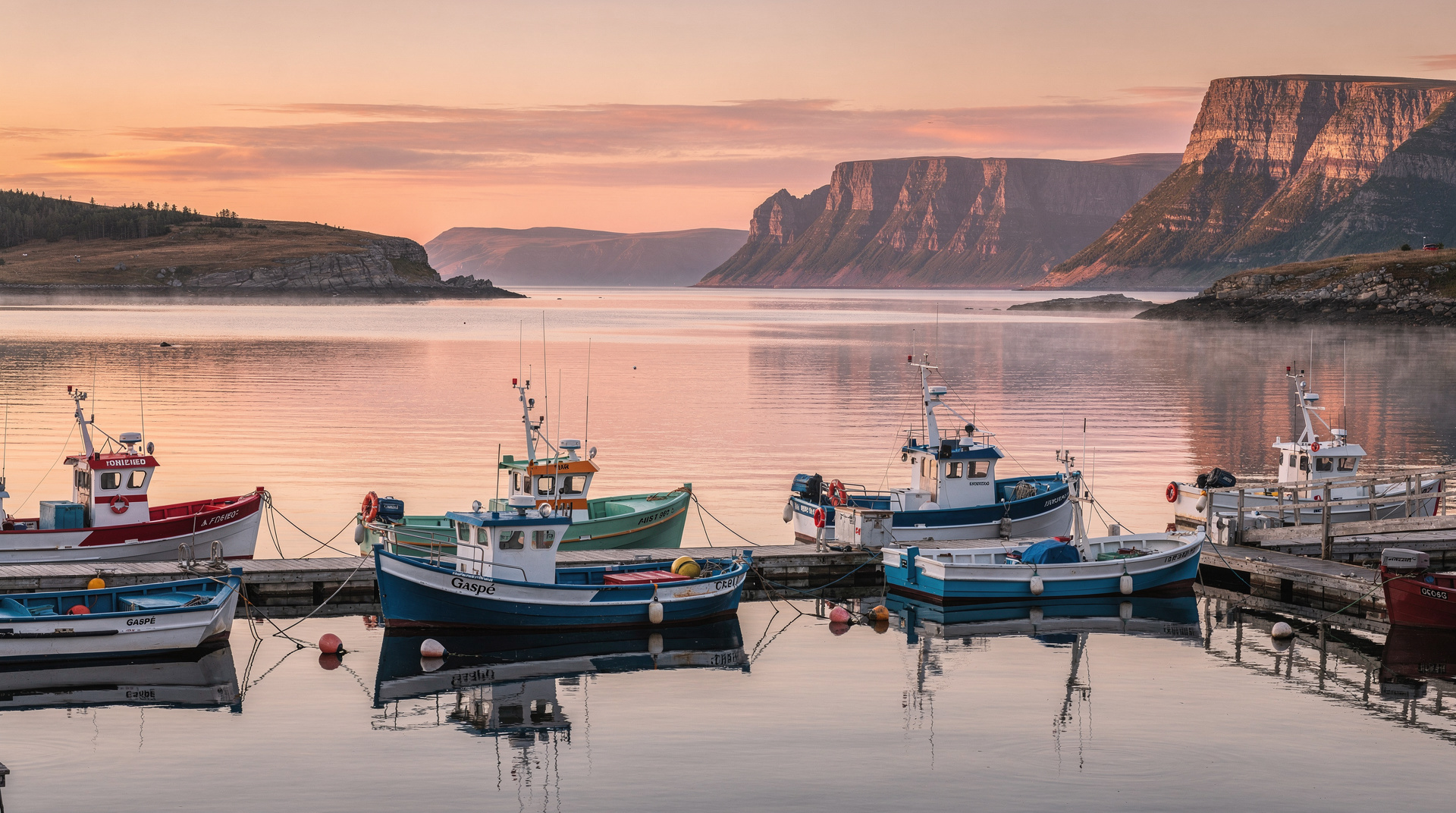
The bay itself rewards a few minutes of quiet attention. It is a deep natural harbour, wide-mouthed toward the gulf, flanked by forested headlands that drop steeply to the water. The stillness of the water on a calm day makes it easy to imagine how this bay would have read to ocean navigators — a refuge, a landmark, a place that pulled you in. Early mornings, with mist still on the water and the light coming flat and grey off the gulf, the scene has an almost archaic quality.
Cathédrale du Christ-Roi
Gaspé’s cathedral, completed in 1969, is an architectural surprise: a large modernist timber structure whose interior vaulting unmistakably suggests the upturned hull of a ship. The design is deliberate, a nod to the fishing heritage that shaped the town through centuries of cod and herring trade. The stained glass windows carry that history further — panels depicting the Mi’kmaq, the Basque and Norman fishermen who fished these waters before Cartier, the French settlement, and the 19th-century British and Irish immigration that gave the south shore its mix of surnames. Entry is free; modest dress is expected.
Musée de la Gaspésie
The regional museum covers the natural and human history of the peninsula through permanent and rotating exhibitions. The most substantive section deals with the Gaspé fishery — the cod and herring industries of the 19th and early 20th centuries that shaped the entire social and economic life of the coast, the collapse of the cod stocks, and the difficult transition that followed. The Mi’kmaq material is handled carefully and deserves time. Open June through October, with a modest admission charge of around 12 CAD.
The route north: Parc national de la Gaspésie
The provincial park covering the Chic-Chocs range — the high, wild interior of the peninsula — is accessed from Sainte-Anne-des-Monts, 180 km west on Route 132. Gaspé is the last major provisioning point before the road turns northwest toward the mountains, so if a Chic-Chocs hike is part of the plan, the supermarkets and outdoor equipment shops here serve that function well. The park’s highest point, Mont Jacques-Cartier, sits above the treeline — a barrens landscape of lichen and windswept heath that feels more Labrador than Southern Quebec. On clear days the views extend to the gulf and beyond.
Coastal walking near Gaspé
The immediate coastline around Gaspé has several short trails that are easy to miss but rewarding. The walk along the Baie de Gaspé foreshore at the edge of town passes working fishing wharves and gives close-up views of the bay that the monument overlooks from above. Small fishing boats, the smell of salt water and diesel, stacked crab traps on the dock — this is the working, unglamorous version of Gaspé that sits alongside the historical narrative, and it is just as worth seeing.
A one-day itinerary in town
For visitors with a genuine half-day rather than a rushed hour, a reasonable order is: morning at the Jacques Cartier Monument and the Baie-de-Gaspé foreshore walk, late morning at the Musée de la Gaspésie, lunch at Café des Artistes, then the cathedral in the early afternoon before heading out toward Forillon or Percé. This sequence keeps walking distances short — most of these sights sit within a 10-minute drive of each other — and leaves the afternoon free for the longer drive to whichever extreme of the peninsula is next on the itinerary.
Forillon: the essential day trip
While Gaspé itself requires a half-day at most, the 40 km drive east to Forillon National Park is non-negotiable. The park occupies the very tip of the peninsula — a narrow headland of limestone cliffs, boreal forest, and exposed beaches where the cold gulf and the colder Atlantic merge. The drive along Route 132 from Gaspé to the park entrance takes the road through Grande-Grave, a preserved 19th-century fishing village that the park administration maintains, its wooden stages and fish-drying facilities intact.
The Cap-Bon-Ami cliffs on the northern shore of the park are one of the most striking landforms in the Maritime east — sheer limestone faces dropping directly to the ocean, with seabirds wheeling below and, in summer, minke and beluga whales occasionally visible offshore. The Grand-Morne trail runs to the headland tip and rewards with 360-degree views of the gulf. See the Forillon National Park page for full trail and logistics detail.
The south road: Percé
The road from Gaspé southeast toward Percé runs 75 km along increasingly dramatic coastline — cliffs giving way to pebble beaches, small fishing communities tucked into coves, the road dropping nearly to sea level and then climbing again to corniche sections where the gulf opens wide to the north.
Percé Rock — the great freestanding limestone arch rising from the sea at the end of the peninsula’s south shore — is one of the most photographed natural landmarks in Canada, and it lives up to the image. Île Bonaventure, a short boat ride offshore, holds one of the largest accessible northern gannet colonies in the world: tens of thousands of birds on the cliffs above, the air thick with calling and the constant traffic of gannets folding into plunging dives over the dark water.
A two-day cluster from Gaspé covers both: Day 1 at Percé and Île Bonaventure; Day 2 at Forillon with the evening back in Gaspé. It is an efficient and deeply satisfying pairing. See the Percé page for boat schedule and colony details.
Practical services in Gaspé
Gaspé is the only place on the peninsula with a full range of urban services — a fact worth acknowledging because it conditions the travel logic of everything within 150 km:
- Supermarkets: IGA and Maxi on Boulevard de York Ouest; stock up here for camping provisions or anything you will need on the remote north shore.
- Fuel: multiple stations, with reasonable pricing relative to the smaller villages further out.
- Pharmacy: Jean Coutu on the main commercial strip.
- Rental car: National has a seasonal office, typically open May through October — confirm availability well in advance for July-August travel.
- ATMs: Desjardins and National Bank branches in the centre.
- Hospital: CISSS de la Gaspésie — Gaspé site; the nearest emergency facility for the tip of the peninsula.
- Internet and mobile coverage: reliable in town, though it drops in and out on much of the coastal road and in the park interiors. Download offline maps before leaving Gaspé.
Where to eat
Le Gaspé Restaurant at the Hôtel des Commandants is the reliable choice for a proper sit-down meal: good seafood built around local Gulf shrimp and crab, a decent wine list, and the professional service of a hotel restaurant that knows its clientele. Budget around 35-55 CAD per person.
Café des Artistes is the town’s casual meeting point for breakfast and lunch — fish chowder made with local catch, local pastries, strong coffee. The kind of place where you overhear conversations between park rangers and lobster fishermen. Around 15-25 CAD.
Resto-Pub L’Ardoise handles informal dinners with pub food and local craft beer after a long day hiking or driving. Prices are fair, the atmosphere is uncomplicated, and it is exactly what you want at 19h after a day at Forillon.
Where to stay
Hôtel des Commandants is the reference hotel in town: 3-star, central, comfortable, with the restaurant described above. Reliable in the way that matters when you arrive tired after a 6-hour drive. Rooms run approximately 120-180 CAD in season.
Hôtel Gaspésie is a smaller, slightly more affordable alternative at 100-150 CAD — less polished but functional.
Camping is available inside Forillon National Park itself (the more atmospheric choice, 40 km east) or at Camping La Faune roughly 10 km south of Gaspé, at sites around 30-40 CAD. Booking Forillon campsites in advance is essential for July and August weekends.
Getting there
By car from Quebec City: Route 132 Est along the south shore of the St Lawrence is the standard route — 625 km and a minimum of 6h30. The drive is long but never dull: the south shore towns of Montmagny, Rivière-du-Loup, and Rimouski are useful breaks, and from Matane eastward the road begins to take on the windswept, edge-of-the-world quality that defines the peninsula. From Rimouski alone, it is 410 km and 4h30.
By air: Air Canada Express serves YGP seasonally from Montreal, typically May through October, with a flight time of roughly 1h45. Prices vary sharply — booking three to four months ahead for July-August travel is strongly advised. A rental car from the airport is essential; there is no alternative.
By bus: Orléans Express runs Montreal-Percé with a Gaspé stop, but the journey exceeds 10 hours and schedules are infrequent. For travellers without cars, this works as a last resort.
Weather and what to pack
Gaspé’s coastal position means weather changes faster than inland Quebec — a clear morning at the Jacques Cartier Monument can turn windy and overcast within an hour, especially near the water. Layers matter more than a single heavy jacket: a windproof shell over a fleece handles most conditions from June through September. July and August average daytime highs around 20–22°C, but wind off the bay drops the felt temperature noticeably, particularly at the monument’s exposed point. Rain gear is worth packing regardless of season; the Gaspé coast sees more precipitation days than Quebec City or Montreal.
A note on the Mi’kmaq presence
The Gespeg Mi’kmaq community has lived around this bay for far longer than the town’s European history, and Gaspé’s museum and monument panels make a genuine effort to present that history alongside Cartier’s arrival rather than as a footnote to it. Visitors interested in the fuller Indigenous history of Quebec beyond the Gaspésie can also see the Wendake guide near Quebec City, which covers Huron-Wendat history and cultural tourism in more depth.
Combining with other destinations
Gaspé is the axis of the peninsula’s tip. Forillon National Park is 40 km east (30 min), Percé is 75 km southeast (1h). A 2-day cluster covers both: Day 1 at Percé and Île Bonaventure; Day 2 at Forillon from the Gaspé base.
The north shore drive toward the Chic-Chocs begins here, through Grande-Vallée and Sainte-Anne-des-Monts — a more remote, less-visited section of the peninsula’s loop that rewards those with time. For the complete route, see the Gaspé Peninsula overview and the Gaspésie road trip itinerary.