Chaudière-Appalaches region overview
South shore of the St. Lawrence opposite Quebec City: Lévis, the Beauce, Bellechasse villages, and the industrial heritage of Thetford Mines.
Updated:
Quick facts
- Regional capital
- Lévis (130 000 inhabitants)
- Access to Quebec City
- Ferry from Lévis to Quebec City (8 min crossing, ~3 CAD, year-round)
- Main sub-regions
- Lévis, La Beauce (Saint-Georges), Bellechasse, Lotbinière
- Foliage
- Appalachian hills, mid-October peak
What’s in this region
Chaudière-Appalaches is Quebec’s south shore directly opposite Quebec City, stretching from the Chaudière River valley southeast into the Appalachian foothills and the US border. It is one of the less-visited regions in the province despite being immediately accessible from one of Quebec’s main tourist hubs — the ferry from Lévis to Quebec City crosses in 8 minutes and runs year-round.
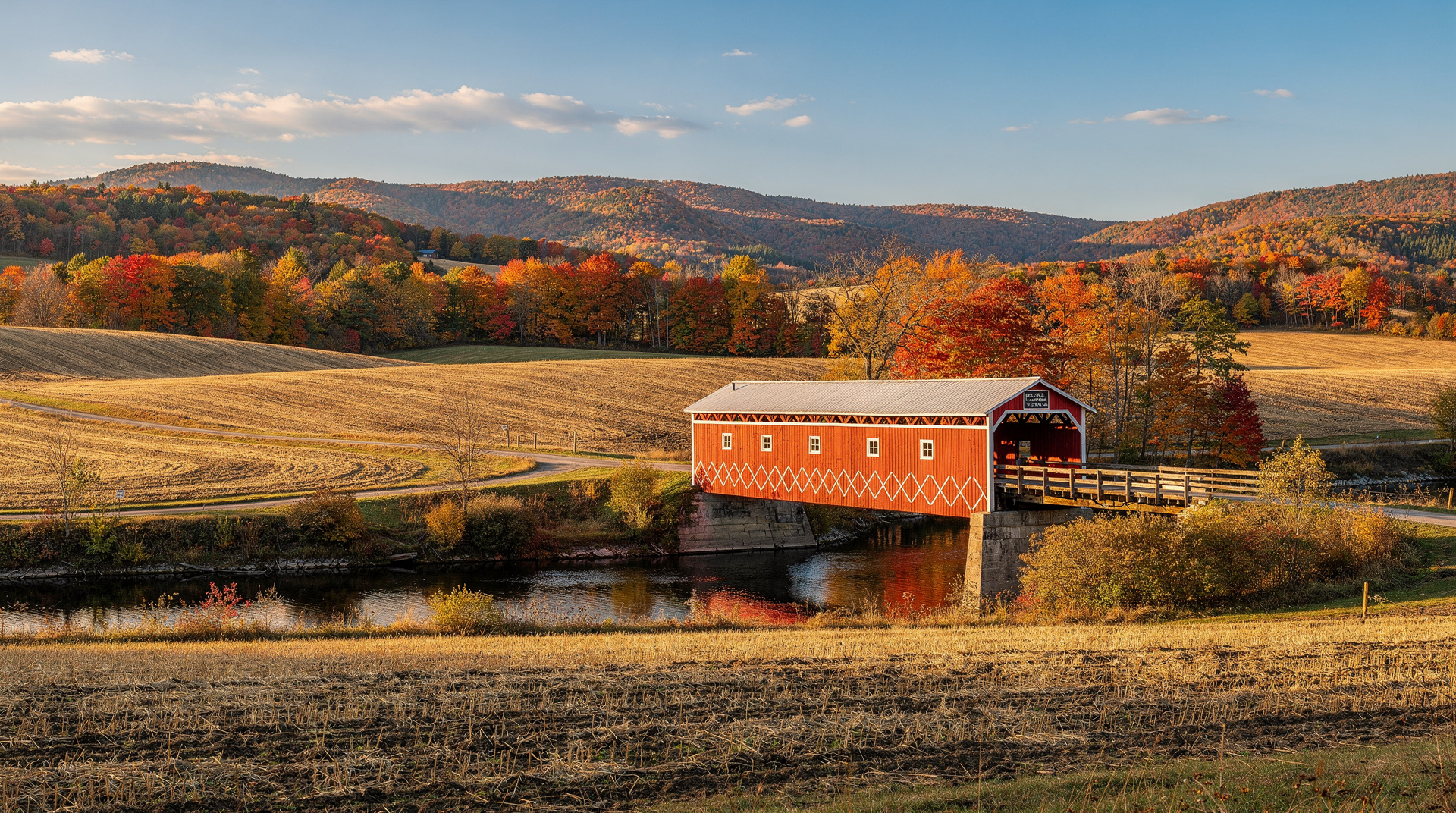
The region rewards visitors who want to experience Quebec’s rural Francophone character outside the main tourism infrastructure. The Beauce valley (along the Chaudière River) has one of the most distinctly Québécois regional identities in the province, shaped by relative geographic isolation, a strong agricultural and entrepreneurial tradition, and a musical culture centred on fiddle and traditional song. Bellechasse, along the south shore of the St. Lawrence east of Lévis, has some of the most beautifully situated villages in the province — small, quiet, and oriented toward the river in a way that feels untouched by the tourist economy.
Top destinations in the region
Lévis
Lévis is the largest city in the region and the south shore counterpart to Quebec City, connected by the iconic car ferry and by the Pierre-Laporte Bridge upstream. It is a fully functional city in its own right — not merely a suburb of Quebec City — with its own historic core (the Vieux-Lévis neighbourhood), the Lévis Forts National Historic Site, and a food scene that has been developing independently of its famous neighbour.
The Forts of Lévis National Historic Site (three interlocking Victorian-era forts overlooking the St. Lawrence) is the main historical attraction. The fortifications were built in the 1860s to counter American invasion fears following the US Civil War; the complex is well-interpreted and the views of Quebec City across the river are outstanding. Guided tours available in summer; entry around 10-15 CAD.
The history and food tasting walking tour in Lévis is a useful introduction to the Vieux-Lévis neighbourhood, the local craft food scene, and the history of the south shore.
The Lévis ferry itself is a minor cultural institution: it has been crossing the St. Lawrence in some form since 1620, and the 8-minute crossing gives you one of the best camera positions in Quebec — the Château Frontenac and the cliffs of Upper Town approaching across the water. Service runs roughly every 30 minutes, 24 hours a day in most seasons. Fare around 3-4 CAD.
Beauce — Saint-Georges and the Chaudière valley
The Beauce is the popular name for the region along the Chaudière River from Sainte-Marie to the US border (Maine). Its capital, Saint-Georges (60 km south of Lévis on Route 173), is a prosperous small city with a particular identity: the Beauce is known for its manufacturing entrepreneurship (home to a disproportionate number of Quebec business founders relative to its population), its traditional Québécois music scene, and an emphatic regional pride that expresses itself through a distinct accent and a local festival calendar.
Saint-Georges has a pleasant waterfront park along the Chaudière River and an attractive church (Saint-Georges Basilica, neo-Roman, early 20th century). For food: La Boulangerie Turmel (genuine local bakery institution) and Le Beau Temps (bistro with local sourcing) are worth noting. The Beauce International snowmobile races in January draw large crowds; for summer visitors, the Chaudière River is used for kayaking downstream toward Lévis.
Saint-Elzéar-de-Beauce has an unusual tourist attraction: the Caverne de Saint-Elzéar, a cave system with well-preserved Pleistocene fossil deposits (~11 000 years old), including the remains of cave bears and other ice age fauna. Guided tours only; reserve in advance (cavernedesaintelzear.com).
Bellechasse — the south shore villages
The Bellechasse MRC (municipal regional county) extends along the south shore east of Lévis, and the villages here — Saint-Michel-de-Bellechasse, Montmagny, Berthier-sur-Mer, Saint-Vallier — constitute some of the most visually striking rural Quebec landscapes accessible by car in a half-day from Quebec City.
Saint-Michel-de-Bellechasse sits on a promontory with an unobstructed view of the St. Lawrence and the Île d’Orléans. The village church (early 18th century) and the views from the riverfront make a 30-minute stop worthwhile. No tourist infrastructure; arrive to look, perhaps have a coffee, and continue.
Montmagny (50 km east of Lévis) is the main town in Bellechasse and the gateway to Grosse-Île National Historic Site — the island in the St. Lawrence that served as Canada’s main quarantine station from 1832 to 1937. The site is accessible only by boat from Montmagny (ferry, seasonal); guided tours cover the Irish famine immigration tragedy of 1847, during which over 5 000 people died on the island while fleeing the famine. It is one of the most moving historic sites in Quebec and remains largely unknown to visitors without prior research. Open late May to mid-October; ferry + guided tour around 80-100 CAD.
Berthier-sur-Mer is the departure point for boat excursions to the Îles du Lac Saint-Pierre and, in autumn, to observe the snow geese migrations. Over 400 000 greater snow geese stop along this portion of the St. Lawrence in October — one of the great wildlife spectacles in eastern Canada. The observation is free from shore at Cap-Saint-Ignace (20 km east); boat excursions add closer access.
Thetford Mines — a note on industrial heritage
Thetford Mines sits in the Appalachian foothills at the southern edge of the region, 85 km from Lévis. It was once the chrysotile asbestos capital of the world: Quebec produced roughly 30% of global asbestos supply through most of the 20th century, and the Thetford Mines area held the largest deposits.
The asbestos industry is controversial and its history in Quebec is complicated. Chrysotile (white asbestos) was argued by its industry supporters to be less dangerous than amphibole forms; the Quebec government defended asbestos mining politically well into the 2000s. The mines closed in 2012; the town has been navigating economic transition since.
The Musée minéralogique et minier de Thetford Mines covers the geology, the social history of the mining era, and the town’s current situation with considerable honesty. It is a genuinely interesting industrial history museum — not a celebration of asbestos, but a documentation of a place built around an industry that turned out to be lethal. Entry around 10 CAD; the mineralogy collection is one of the best in Quebec.
Whether this warrants a dedicated visit depends entirely on your interest in industrial history. For most visitors, it is too far off the main route without a specific reason. If you are driving between Quebec City and the Eastern Townships via Route 112, it is a logical stop.
Suggested itinerary for the region (2 days)
Day 1: Lévis and surroundings Morning: take the ferry from Quebec City to Lévis (or drive over the bridge). Walk Vieux-Lévis, visit the Forts. Afternoon: drive east along the Route du Fleuve (Route 132) through Saint-Michel-de-Bellechasse to Montmagny — river views throughout. Evening: dinner in Lévis, return to Quebec City by ferry.
Day 2: Beauce or Bellechasse depth Option A (Beauce): drive south on Route 173 to Saint-Georges (~1h). Riverside walk, lunch, Caverne de Saint-Elzéar in the afternoon (~30 min detour). Return to Lévis or Quebec City via Route 173.
Option B (Bellechasse east): continue past Montmagny to Berthier-sur-Mer (snow geese in October) and the Grosse-Île ferry if the season and timing align. Return via Route 132.
Getting around
A car is essential for exploring the region beyond Lévis. The Route 132 south shore highway follows the St. Lawrence from Lévis eastward and is one of Quebec’s more scenic river-level drives. Route 173 runs south from Lévis into the Beauce.
No Via Rail service operates within the region beyond the Lévis station (accessible from Quebec City via the ferry connection to the train network). The bus network (Autobus transit) covers the main towns but is slow and infrequent for tourist purposes.
Cycling
The Route Verte corridor on the south shore runs along Route 132 from Lévis east toward Kamouraska and the Bas-Saint-Laurent. The flat terrain near the river makes this accessible for most cyclists; the section from Lévis to Montmagny (~50 km) takes half a day with stops.
Connecting with adjacent regions
- East toward Bas-Saint-Laurent: Route 132 continues east past Montmagny toward Kamouraska and Rimouski. The Bas-Saint-Laurent region begins around La Pocatière.
- South toward Eastern Townships: Route 112 from Thetford Mines connects to Sherbrooke and the Eastern Townships.
- North across the river: the Quebec City ferry links directly to Old Quebec and the Capitale-Nationale region.